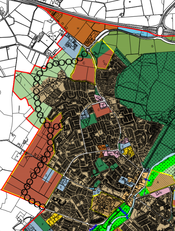
This concept is a proposed ring road to the west of Celbridge from the Applegreen roundabout to the R403/Clane Road, as shown below. The idea is to alleviate the Maynooth Road by providing alternative access to J6 on the M4.

The Minister for Housing, Planning, Community and Local Government provided feedback that the early draft of the 2017 Local Area Plan had too much development on the northwestern side of Celbridge. The fear was that the excessive development combined with the western ring road would add significantly to congestion on the M4.
In response, the KCC Chief Executive removed the western ring road, along with much of the zoning for new residential development alongside that ring road. Instead, the strategy was to build more residential housing towards Hazelhatch rail station and direct road development toward feeding traffic to the rail station.
Sources:
